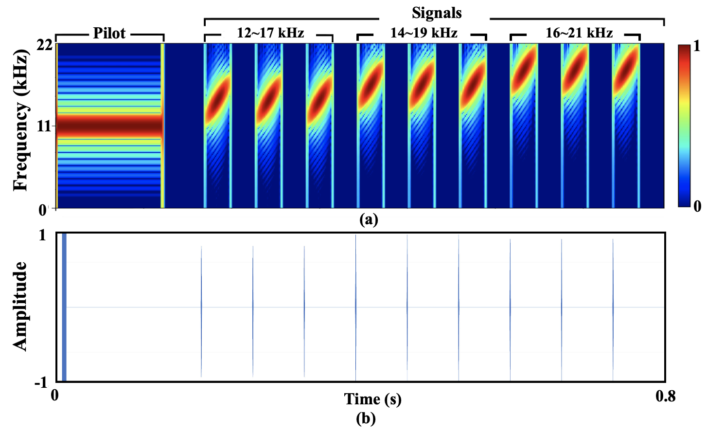
A GeoAI solution for mosquito control and disease management.

Overview
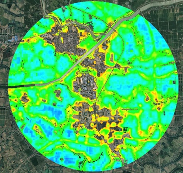
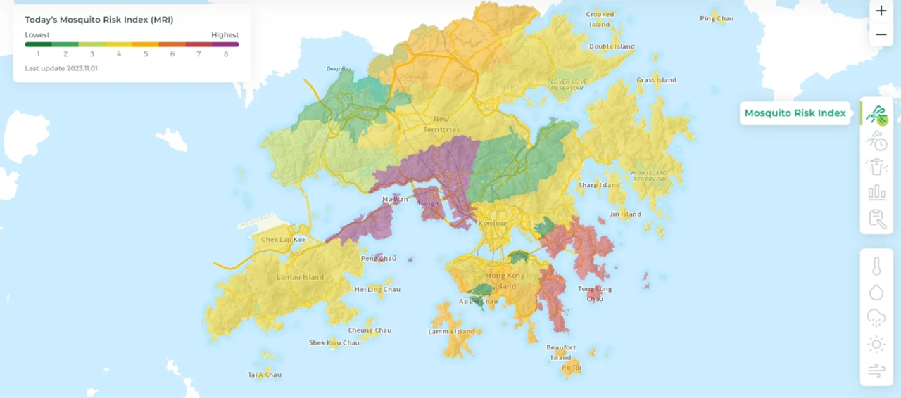
This solution develops an innovative solution that could near-real time monitor and predict mosquito risk index (MRI) in the next three days to strengthen mosquito surveillance and prevention. Through real-time interactive maps, more useful mosquito risk index information is provided to alert citizens and associations to black spots with serious mosquito infestation and improve the effectiveness of mosquito-borne disease surveillance.
Technical name of innovation
A GeoAI solution for mosquito control and disease management.
Research completion
2024
Problem addressed
Dengue fever or mosquito-borne disease is an acute infectious disease caused by a virus transmitted by mosquitoes and can cause death.
Innovation
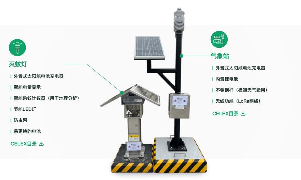
- The IoT devices developed in this project will be installed at strategic locations: smart mosquito killer lamps and weather monitoring stations to collect geospatial information on meteorological conditions and mosquito populations.
Key impact
- Monitor mosquito abundance level
- Offer mosquito risk index (MRI) and interactive maps to alert citizens and associations to black spots with serious mosquito infestation and improve the effectiveness of mosquito-borne disease surveillance.
- Improve the effectiveness of mosquito-borne disease surveillance and predictive solutions.
Award
- LU Research & Knowledge Transfer Fund Award 2022 (Government-Industry-Academia Collaboration)
Application
- Environmental Health
- GeoAI
- AIoT
- Geospatial analytics
Lingnan University
Lingnan University, a venerable institution in Hong Kong's academic landscape, has a rich heritage that dates back to its founding in Guangzhou in 1888. Known in its earlier years as Lingnan Xuexiao and subsequently as Lingnan University, the institution flourished in the field of higher education until 1952. It was reborn in Hong Kong in 1967 and has since aspired to evolve into a distinguished research-focused liberal arts university for the digital age. Lingnan is committed to excellence in teaching, learning, research, and fostering community ties, aiming for international acclaim.
Enquiry